Trimble layers
Contents
The Mobile Maps SDK examples require that you first complete the initial project set-up.
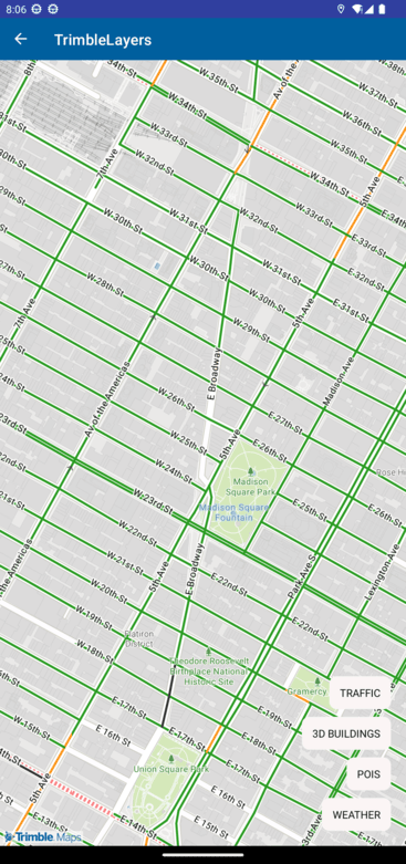
Add specialized layers to the map, ranging from weather alerts to 3D buildings.
TrimbleLayers.xaml
<?xml version="1.0" encoding="utf-8" ?>
<ContentPage xmlns="http://schemas.microsoft.com/dotnet/2021/maui"
             xmlns:x="http://schemas.microsoft.com/winfx/2009/xaml"
             x:Class="TrimbleMaps.MapSDK.Sample.TrimbleLayers"
             Title="TrimbleLayers" xmlns:TrimbleMaps="clr-namespace:TrimbleMaps.Controls.Forms;assembly=TrimbleMaps.MapsSDK">
    <Grid>
         <TrimbleMaps:MapView
      x:Name="Map"
      ShowUserLocation="true"
      UserLocationTracking="None"
      ZoomMaxLevel="21"
      CompassEnabled="True"
      CompassFadeFacingNorth="False"
      />
        <!-- VerticalStackLayout for the button -->
        <VerticalStackLayout Padding="20" Spacing="10" VerticalOptions="End">
            <Button Text="TRAFFIC"
                    Clicked="OnClickChangeLayer"
                    BackgroundColor= "#FAF5F5"
                    TextColor="Black"
                    CornerRadius="10"
                    HorizontalOptions="End"
                    VerticalOptions= "End"
                    CommandParameter="traffic" />
            <Button Text="3D BUILDINGS"
                    Clicked="OnClickChangeLayer"
                    BackgroundColor= "#FAF5F5"
                    TextColor="Black"
                    CornerRadius="10"
                    HorizontalOptions="End"
                    VerticalOptions= "End"
                    CommandParameter="3d_buildings" />
            <Button Text="POIS"
                    Clicked="OnClickChangeLayer"
                    BackgroundColor= "#FAF5F5"
                    TextColor="Black"
                    CornerRadius="10"
                    HorizontalOptions="End"
                    VerticalOptions= "End"
                    CommandParameter="pois" />
            <Button Text="WEATHER"
                    Clicked="OnClickChangeLayer"
                    BackgroundColor= "#FAF5F5"
                    TextColor="Black"
                    CornerRadius="10"
                    HorizontalOptions="End"
                    VerticalOptions= "End"
                    CommandParameter="weather" />
        </VerticalStackLayout>
    </Grid>
</ContentPage>
TrimbleLayers.xaml.cs
using CommunityToolkit.Maui.Alerts;
using CommunityToolkit.Maui.Core;
using TrimbleMaps.Controls.Forms;
namespace TrimbleMaps.MapSDK.Sample
{
    public partial class TrimbleLayers : ContentPage
    {
        public TrimbleLayers()
        {
            InitializeComponent();
            Setup();
        }

        private void Setup()
        {
            Map.Center = new TrimbleMaps.MapsSDK.LatLng(40.74304499593169, -73.98917577717128);
            Map.ZoomMinLevel = 4;
            Map.MapStyle = MapStyle.MOBILE_DAY;
        }

        private void OnClickChangeLayer(object sender, EventArgs e)
        {
            ResetMapLayer();

            if (sender is Button button && button.CommandParameter is string page)
            {
                switch (page)
                {
                    case "traffic":
                        Map.Center = new TrimbleMaps.MapsSDK.LatLng(40.74304499593169, -73.98917577717128);
                        Map.Functions.ToggleRoadSurfaceLayer();
                        Map.Functions.ToggleTrafficLayer();
                        Map.ShowTrafficLayer = true;
                        Toast.Make("Traffic Layer is enabled", ToastDuration.Short, 14).Show();
                        break;
                    case "3d_buildings":
                        Map.Center = new TrimbleMaps.MapsSDK.LatLng(40.74304499593169, -73.98917577717128);
                        Map.Pitch = 60;
                        Map.Functions.Toggle3dBuildingLayer();
                        Map.Show3dBuildingLayer = true;
                        Toast.Make("3D Building Layer is enabled", ToastDuration.Short, 14).Show();
                        break;
                    case "pois":
                        Map.Center = new TrimbleMaps.MapsSDK.LatLng(40.372447878728025, -74.48960455530846);
                        Map.Functions.TogglePoiLayer();
                        Map.ShowPoiLayer = true;
                        Toast.Make("POI Layer is enabled", ToastDuration.Short, 14).Show();
                        break;
                    case "weather":
                        Map.Center = new TrimbleMaps.MapsSDK.LatLng(40.372447878728025, -74.48960455530846);
                        Map.ZoomLevel = 4;
                        Map.Functions.ToggleWeatherRadarLayer();
                        Map.ShowWeatherRadarLayer = true;
                        Toast.Make("Weather Radar Layer is enabled", ToastDuration.Short, 14).Show();
                        break;
                }
            }
        }

        private void ResetMapLayer()
        {
            Map.ZoomLevel = 15;
            Map.Pitch = 0;
            if (Map.ShowTrafficLayer)
            {
                Map.Functions.ToggleTrafficLayer();
                Map.ShowTrafficLayer = false;
            }
            if (Map.Show3dBuildingLayer)
            {
                Map.Functions.Toggle3dBuildingLayer();
                Map.Show3dBuildingLayer = false;
            }
            if (Map.ShowPoiLayer)
            {
                Map.Functions.TogglePoiLayer();
                Map.ShowPoiLayer = false;
            }
            if (Map.ShowWeatherRadarLayer)
            {
                Map.Functions.ToggleWeatherRadarLayer();
                Map.ShowWeatherRadarLayer = false;
            }
        }
    }
}